
mm Wave Link Budget Calculator
Enter in the Tx, Channel and Rx parameters and the available SNR will be calculated. See below for a detailed explanation of each parameter. | ||
|
Tx Power T-Line Loss Antenna Gain |
Frequency Path Length Vapour Density Region Availability Path Elevation Polarisation |
Antenna Gain T-Line Loss Noise Figure Temperature Bandwidth |
|
Tx EIRP |
Free Space Loss Vapour Attenuation O2 Attenuation Rain Rate Rain Attenuation Total Path Loss |
Rx Signal Level Rx Noise Floor |
|
|
SNR |
|
Parameter Definitions
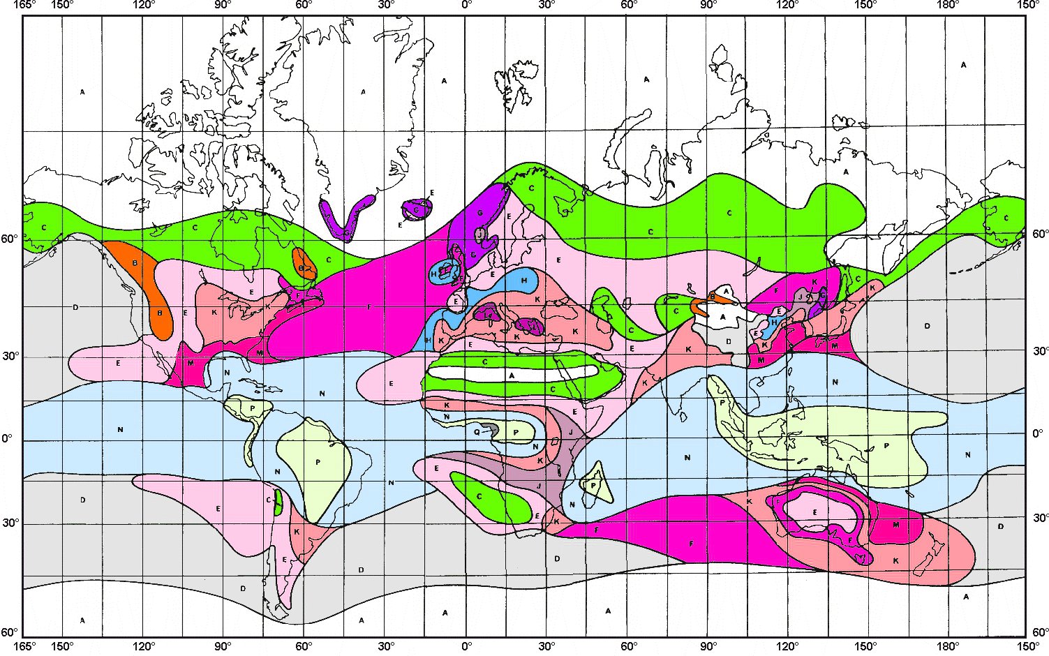
*Region: Various regions around the world have been grouped according to their rainfall rates. Using the map below, select the region code corresponding to the area in which the link will be deployed.
Click for a larger view
*Availability: Linked to the Region parameter and the degree to which the link may become unavailable due to rain attenuation. Select according to the desired link robustness.
*Vapour Density: This variable reflects the humidity of the atmosphere in which the link is deployed. An average value of 7.5 is the default, though the table below reflects some other typical conditions from which to choose.
| Vapour Density | Surface Temperature | Surface Relative Humidity |
| 0 | 7 | 0.000 |
| 3 | 11 | 0.300 |
| 7.5 | 15 | 0.584 |
| 10 | 19 | 0.612 |
| 13 | 23 | 0.631 |
| 15 | 27 | 0.581 |
| 17 | 31 | 0.530 |
| 21 | 35 | 0.529 |
*Path Elevation: Takes into account the increased path due to Tx and Rx being at different altitudes. Enter the elevation in degrees according to the link geometry.
*Polarisation: Takes into account the polarisation of the Antenna. Processes Vertical as 90°, Horizontal as 0° and Circular as 45°.
*SNR: For the given link parameters, the received signal to noise ratio (SNR) at the chosen level of link availability is presented. For example, for 99.999% of the time an SNR of 13.49dB or better is predicted; only for 0.001% of the time is the SNR predicted to be worse than 13.49dB.
References
*D Hobbs "Millimetre Wave Frequency Back Haul"
*ITU-R P.676-5 "Attenuation by atmospheric gases"
*ITU-R P.838-3 "Specific attenuation model for rain for use in prediction methods"
*National Oceanic and Atmospheric Administration "U.S. Standard Atmosphere"